
Your Underground Vision
See What Others Miss with Multi-Award Winning Underground Mapping Technology
The Loupe TEM System is essentially a fish finder for the ground – a revolutionary portable time-domain electromagnetic system that reveals what traditional magnetic surveys miss. Where magnetic surveys show very little, Loupe “lights up” the geology with unprecedented clarity, providing depth and dip informat
ion up to 50 meters deep.
Why Your Exploration Program Needs Loupe
As a geophysicist, I cannot fathom how exploration and mining companies don’t routinely use this equipment. This type of survey should be standard practice for mineral exploration, offering a complete picture of subsurface geology that traditional methods simply cannot provide.
Revolutionary Capabilities
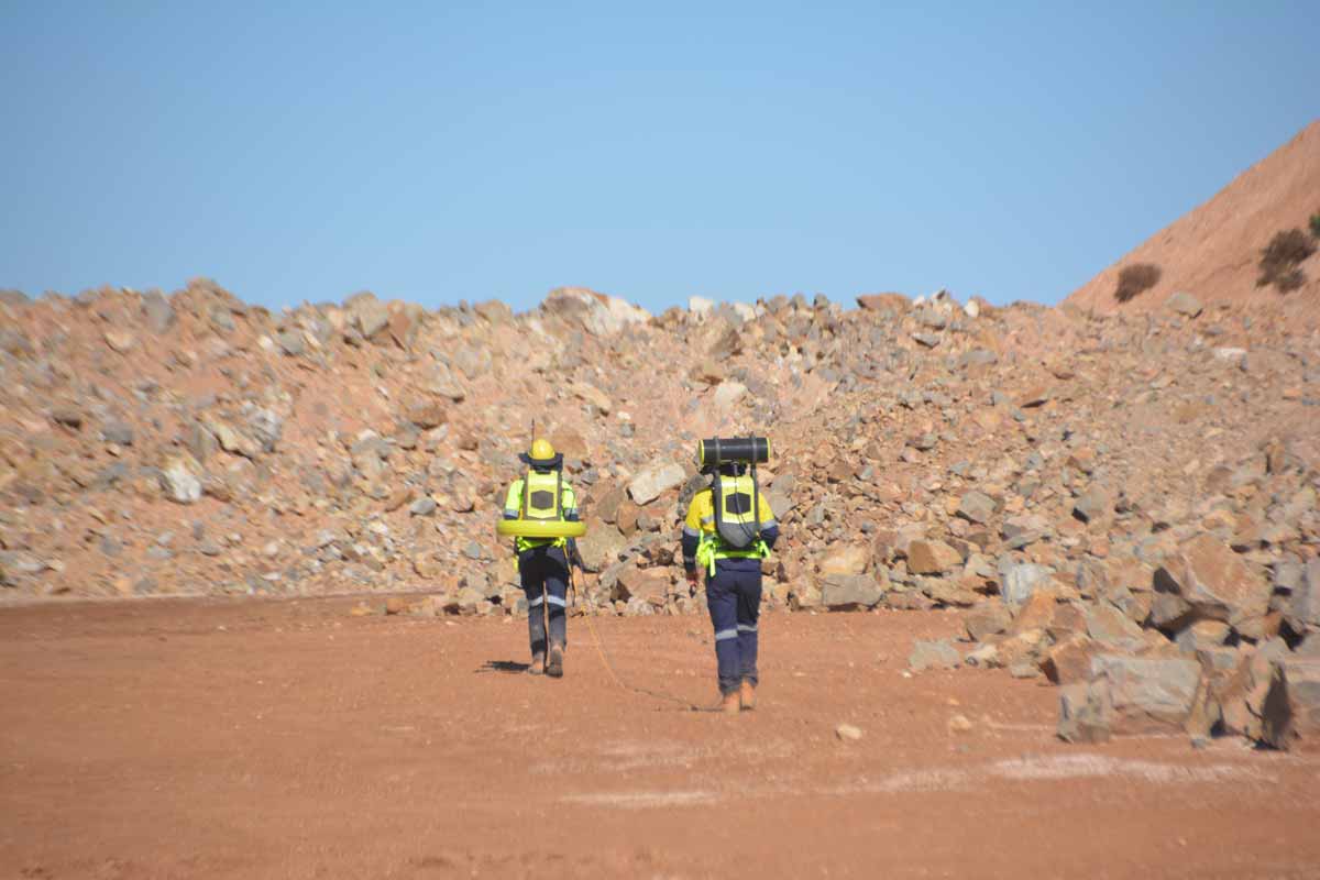
Walk & Map Technology
Fully portable time-domain EM system designed for operation while walking. Cover more ground, faster than ever before.
Extreme Precision
High spatial resolution EM data from near-surface investigations. See geological features others miss entirely.
Urban-Ready Performance
Engineered to generate pristine TEM data even at urban and industrial sites with significant EM interference.
Flexible Frequency Options
Range of transmitter frequencies and sampling options to optimize for your specific geological targets.
Complete Data Suite
Full time-series data storage, processing, and visualization capabilities for comprehensive analysis.
Proven Field Performance
Continuous improvements through real-world case studies across diverse geological environments.
Applications Across Industries
Mineral Exploration
Ideal for most mineral types. Discover ore bodies that magnetic surveys completely miss. Make this essential tool part of your routine exploration program.
Geotechnical Surveys
Provide essential subsurface data for construction and engineering projects with confidence and precision.
Archaeological Mapping
Non-invasive detection of buried structures and artifacts, preserving sites while revealing their secrets.
Groundwater Detection
Map aquifers and water-bearing formations with precision for water resource management and development.
Environmental Assessment
Detect contamination plumes and monitor remediation progress with accurate subsurface conductivity mapping.
Geological Research
Advanced conductivity mapping for academic and research applications, pushing the boundaries of subsurface understanding.
Transform Your Subsurface Investigations
The Loupe TEM System represents a paradigm shift in how we investigate the subsurface. Its unique combination of portability, depth capability, and data quality makes it invaluable for modern exploration challenges.
Whether you’re searching for minerals, mapping groundwater resources, conducting environmental assessments, or planning infrastructure projects, Loupe transforms guesswork into precision mapping.
Ready to See Beneath the Surface?
Join the growing number of companies revolutionizing their exploration programs with Loupe. Discover what you’ve been missing with the system that lights up geology where others pattern drill.
Contact us today to schedule a demonstration or request detailed specifications.