

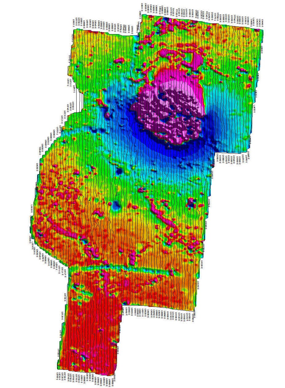

An obvious volcanic plug can be seen in the north of the survey, but more subtle and smaller features can be seen throughout this ultra-high resolution ground magnetic survey
Coal magnetic surveys are usually done at an ultra-high resolution. That is, with a line spacing of 10m.
However the best ground magnetic data I have ever seen was over a gold prospect in Western Australia. The explorer was interested detecting mineralized structures trending east-west AS WELL AS north-south dolomite dikes intersecting the mineralisation. Ground magnetic surveys have two critical survey parameters. Line direction and line spacing. The line spacing is often chosen for economic reasons, but optimally it should be no more than the depth to what you are looking for. The line direction should be perpendicular to the geology of interest. In this case, the structures of interest were perpendicular, so making the line spacing perpendicular to both required doing the survey with both east-west AND north-south lines. The north-south lines were done at a 10m line spacing, and the east-west lines at a 20m line spacing.
The data resolution was simply spectacular. The absolute accuracy and negligible heading error of the GSMP-35 potassium magnetometers meant that the two surveys (with different line directions) were seamless when gridded as one survey.
Such ultra-high resolution surveys are rare in mineral exploration, though many of the best gold explorers do them. In fact there is now a large hole in the ground at this survey location and the company won the coveted title of gold explorer of the year a few years back.
In contrast, coal explorers realize the benefit of ultra-high resolution ground magnetic surveys and they routinely commission them. At a regional scale, magnetometers can be used to map basin shapes. But more commonly, ground magnetic surveys are used in coal exploration and mining to maps hazards such as basaltic intrusions. These intrusions can be quite narrow and small so ultra-high resolution ground magnetic surveys are required to detect and map them.
The intrusion shown in the image is a large and obvious volcanic plug. However there are other smaller and more subtle features in the data only detected with ultra-high resolution ground magnetic surveys at a 10m line spacing.
Modern Mag are experts in ground magnetic surveys for coal. We have standard 11 qualifications among others. Our equipment is modern and ideal for these ultra-high resolution surveys. Our built in GPS has the accuracy required to do such surveys, and we provide final data in industry standard formats along with a logistics report.
One of our offices is conveniently location on the east coast to support our coal clients.
Coal magnetic surveys by Modern Mag.
